平
家
物
語
平
家
物
語
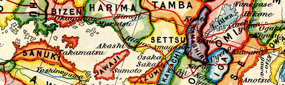
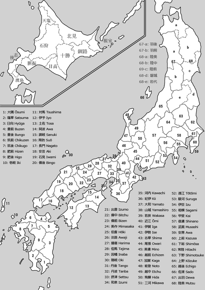
To the right is an excellent map of Japan's Provinces during the time of Tokugawa Ieyasu (1543 - 1616) by Murdoch and Yamagata (1903)

To the left is a map of the capital I made myself. Clicking the image will redirect you to the interactive map, where you can get more information on various sites insite the capital (NOTE: work in progress). To the right the wikipedia map.
Another nice map can be found HERE. It has an option to overlay the map of the old capital onto a map of present-day Kyoto and also features the Rokuhara (六波) district. (Site in Japanese)

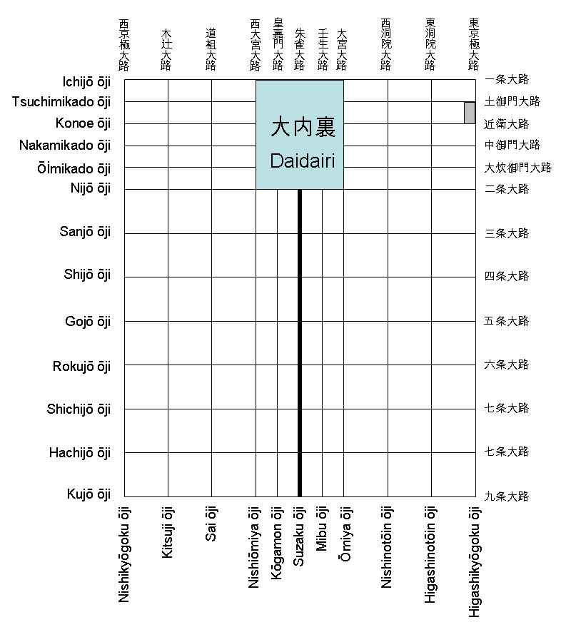
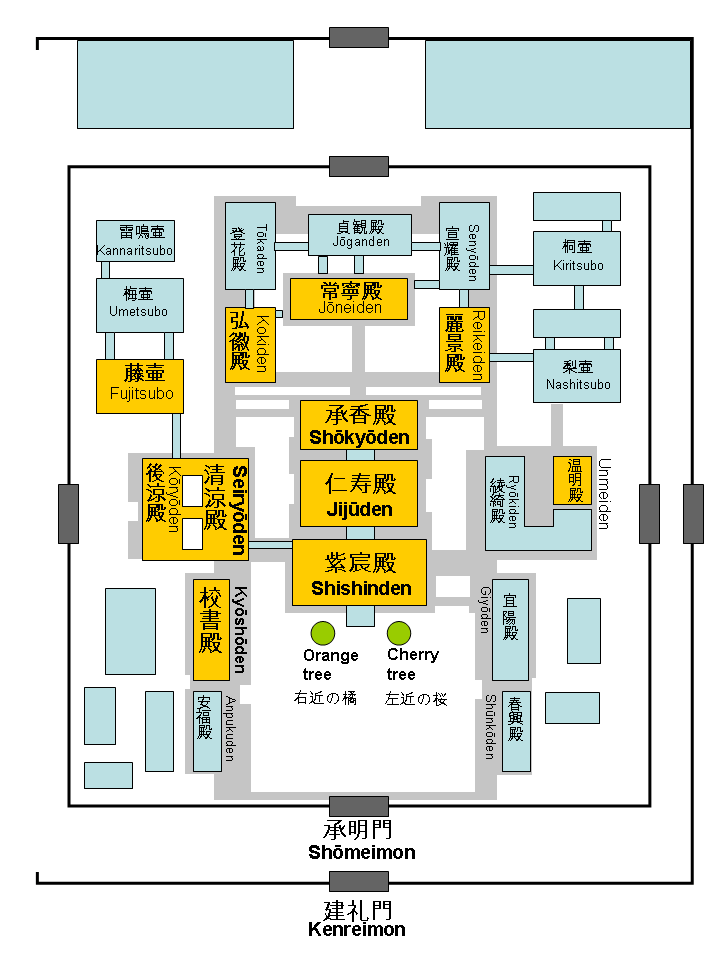
Again, to the left is the map I made myself, which redirects to the interactive map (NOTE: work in progress). To the right the wikipedia map.

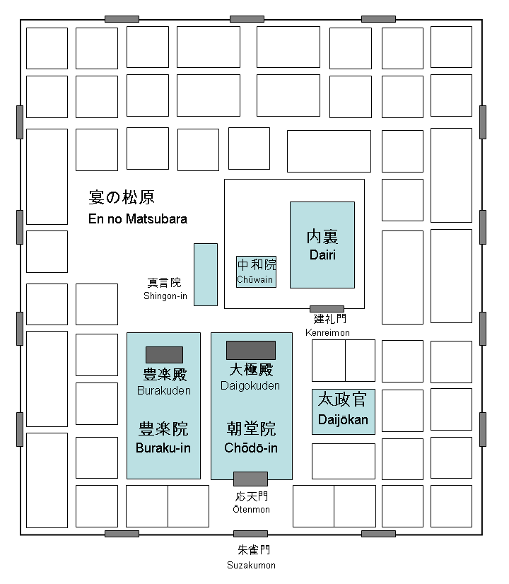
To the left my interactive map (NOTE: work in progress). To the right the wikipedia map.
